Our Earth is one of the most beautiful planets in the solar system without any doubt. Or may be, we are the ones living in it so we find it the most beautiful planet. But mostly human’s don’t care about the things they posses and look into other’s pocket to find beauty and peace. Today I would like to share with you some of the most amazing places on Earth which are extremely beautiful, where I wish I could visit once in my life. They are just simply amazing and appears to be computer generated images. If you have that heart and brain of appreciating beauty and that loving nature, it might bring tears in your eyes with happiness to see these beautiful pictures. I’m sure after looking at these 25 most amazing places on Earth you will die to go there and see with your own eyes.
1- Lapland – Finland
Photograph by: Niccolò Bonfadini
Finnish Lapland – During winters, with temperatures ranging from -40 to -15, the trees in some areas of Finnish Lapland gets completely covered by snow and ice. This makes for a unique landscape, where everything is white and frozen as far as the eyes can see. [Locate Lapland Finland on Google Map]
2- Avatar Hallelujah Mountain (Formerly Known As: Southern Sky Column)
In Wulingyuan National Park in Zhangjiajie of China’s Hunan Province, a 266-square- mile preserve that includes a stone forest of 3100 quartz sandstone pillars, lush valleys, dense forests, a mountain lake, caves, waterfalls and streams. The most memorable of the peaks, the one featured in the posters for Avatar, seems to be floating in space. As part of a move to capitalize on the huge popularity of Avatar in China, this 3544-feet tall pillar of sandstone was recently renamed to Avatar Hallelujah Mountain. The Avatar’s designers used radio controlled drone helicopters to photograph the Eerie Peaks of Zhangjiajie. [Locate Avatar Hallelujah Mountain on Google Maps]
3. Uyuni Salt Flat, Bolivia
(Photograph by Heiko Meyer, laif/Redux)
Earth and the sky meets together and kiss each other at Salar de Uyuni, a vast salt flat in southwest Bolivia. It is a dried-up lake which left around 4000 square mile basin of salt making it the world’s largest deposit. It is also the Earth’s flattest places. [Locate Salar de Uyuni Salt Flat Bolivia on Google Maps]
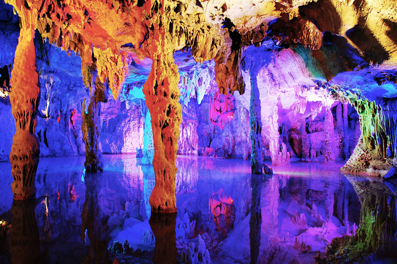
4. Reed Flute Cave, China
The Reed Flute Cave is an amazing tourist place in Guilin, Guangxi, China. It is a natural limestone cave with multicolored lighting and has been one of Guilin’s most interesting attractions for over 1200 years. It is over 180 million years old. The cave got its name from the type of reed growing outside, which can be made into melodious flutes. Reed Flute Cave is filled with a large number of stalactites, stalagmites and rock formations in weird and wonderful shapes. Inside, there are more than 70 inscriptions written in ink, which can be dated back as far as 792 AD in the Tang Dynasty. These aged inscriptions tell us that it has been an attraction in Guilin since ancient times. It was rediscovered in the 1940s by a group of refugees fleeing the Japanese troops. [Wikipedia] [Locate Reed Flute Cave, China on Google Maps]
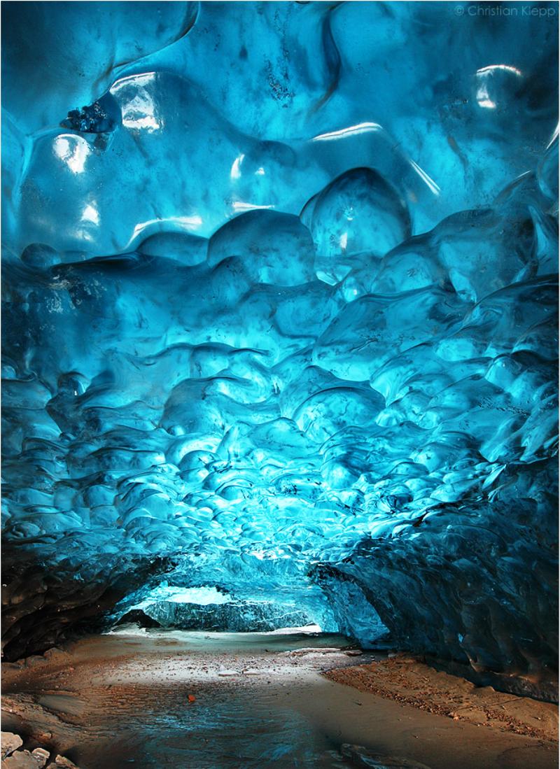
5. Skaftafell Ice Cave
Located within Iceland’s own Skaftafell National Park, the whimsical crystal Skaftafell ice cave is the result of centuries old ice coming down the slopes of Öræfajökull. Ice caves are temporary structures that appear at the edge of glaciers. They look amazingly beautiful from the inside. This particular cave is located on the frozen lagoon of the Svínafellsjökull glacier in Skaftafell, Iceland. The centuries old ice coming down the slopes of Öræfajökull via Svínafellsjökull glacier has metamorphosed into highly pressurized glacier ice that contains almost no air bubbles. [Locate Skaftafell National Park on Google Maps]
6. Antelope Canyon, United States
Photograph by: Art of HDR
Photograph by: Wikimedia Commons
The Antelope Canyon is both the most visited and most photographed slot canyon in the American Southwest. One glance at the smooth, orange-red walls and it’s easy to see why. This canyon was formed by flash flooding and other subaerial processes that eroded the sandstone. As the rains continue (in 2006, a flood lasted for more than 36 hours) the canyon’s landscape slowly forges on in its topical transformation. While scientists are unsure of when people discovered the cave, local Navajos claim that the surreal canyon has been part of their cultural heritage for ages. [Locate Antelope Caynon, USA on Google Maps]
7. Maldives Islands Bioluminescent Phytoplankton
Photograph by: Will Ho
While vacationing on the Maldives Islands, Taiwanese photographer Will Ho stumbled onto an incredible stretch of beach covered in millions of bioluminescent phytoplankton. These tiny organisms glow similarly to fireflies and tend to emit light when stressed, such as when waves crash or when they are otherwise agitated. While the phenomenon and its chemical mechanisms have been known for some time, biologists have only recently began to understand the reasons behind it. [Locate Maldives Islands on Google Maps]
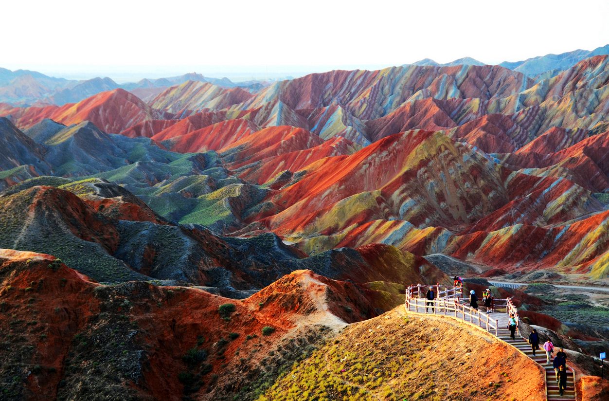
8. Zhangye Danxia Landform Geological Park in China
The mountains are part of the Zhangye Danxia Landform Geological Park in China. Layers of different colored sandstone and minerals were pressed together over 24 million years and then buckled up by tectonic plates, according to the Telegraph. [Locate Zhangye Danxia Landform Geological Park China on Google Maps]
9. Waitomo Glowworm Caves, New Zealand
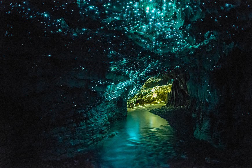
The Waitomo Glowworm Caves, located just outside the main Waitomo township on the North Island of New Zealand, is a famous attraction because of a sizeable population of glowworms that live in the caves. Glowworms or Arachnocampa luminosa are tiny, bioluminescent creatures that produce a blue-green light and are found exclusively in New Zealand. The Waitomo Glowworm Caves were first explored in 1887 by local Maori Chief Tane Tinorau accompanied by an English surveyor Fred Mace. Local Maori people knew of the Caves existence, but the subterranean caverns had never been extensively explored until Fred and Tane went to investigate. They built a raft of flax stems and with candles in hand, floated into the cave where the stream goes underground. [Locate Waitomo Glowworm Caves, New Zealand on Google Maps]
10. Lake Hillier, Australia
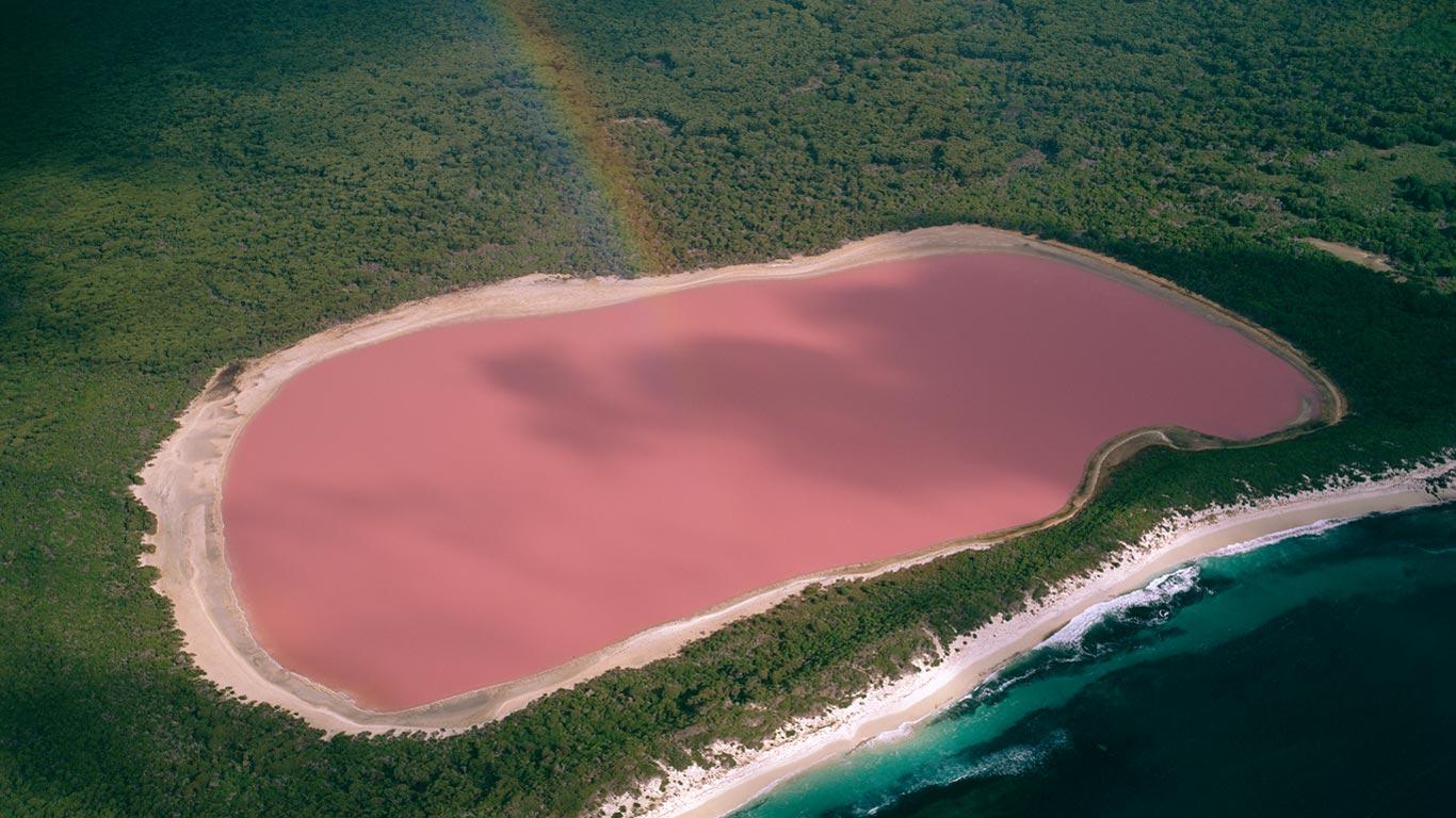
Lake Hillier, is a lake on Middle Island, the largest of the islands and islets that make up the Recherche Archipelago, Western Australia. The most notable feature of the lake is its pink colour. It is such a significant distinguishing feature of the archipelago that air passengers often take note of it. The colour is permanent, and does not alter when the water is taken in a container. The length of the lake is about 600 metres (2,000 ft). The lake is surrounded by a rim of sand and a dense woodland of paperbark and eucalyptus trees with a narrow strip of sand dunes covered by vegetation separating it to the north from the Southern Ocean. [Wikipedia] [Lake Hillier Australia on Google Maps]
11. Yuanyang Rice Terraces, China
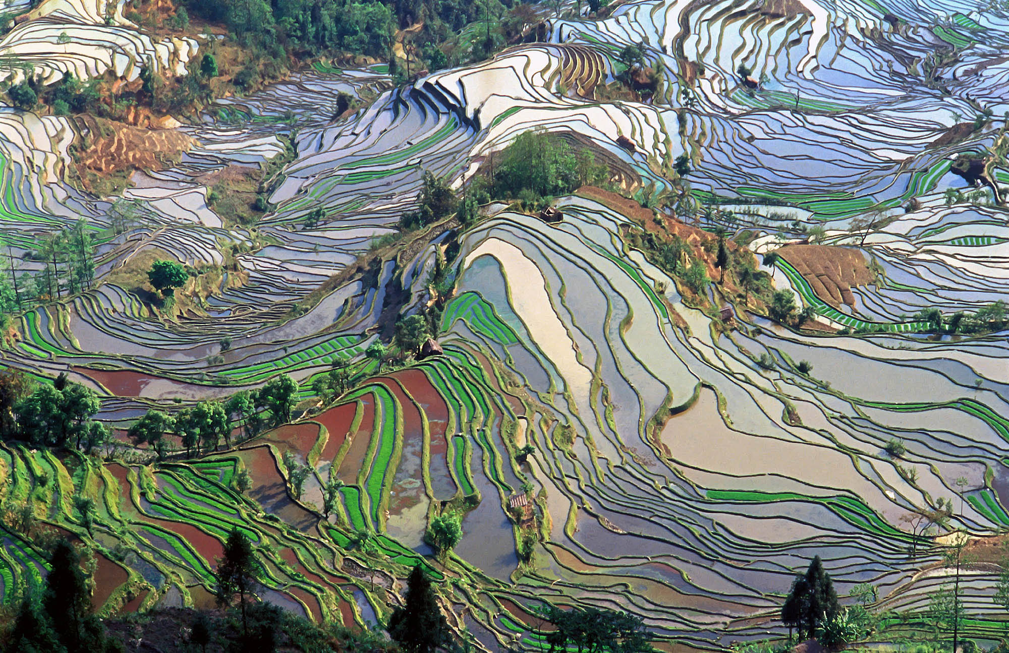
Yuanyang Rice Terraces, located on the southern slopes of Ailao Mountain in Yuanyang County (part of Honghe Hani Autonomous Prefecture) and located in the south of Yunnan Province has been a masterpiece of the ingenuity of the Hani people for generations. Southern Ailao Mountain, with this typical tiered landscape, is famed for its unique frontier scenery. [Locate Yuanyang Rice Terraces, China on Google Maps]
12. Pamukkale Turkish Bath Pool
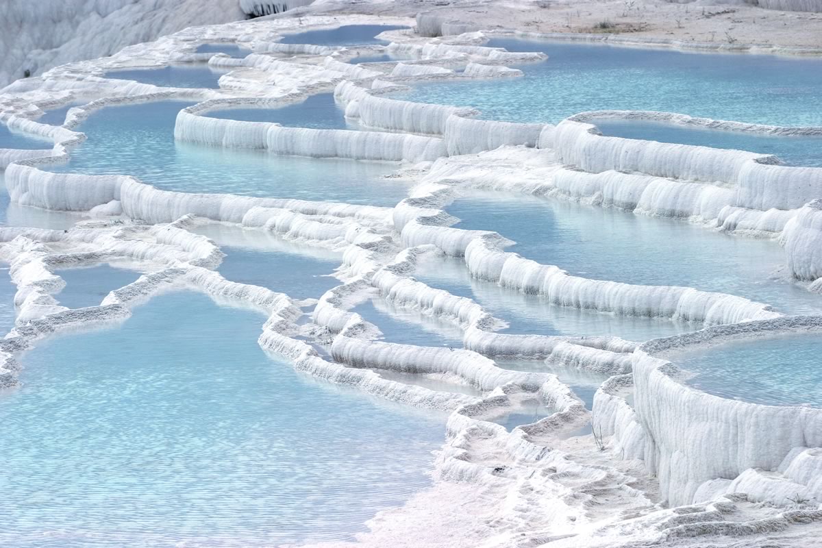
Pamukkale, meaning “cotton castle” in Turkish, is a natural site in Denizli Province in southwestern Turkey. The city contains hot springs and travertines, terraces of carbonate minerals left by the flowing water. It is located in Turkey’s Inner Aegean region, in the River Menderes valley, which has a temperate climate for most of the year. The ancient Greco-Roman and Byzantine city of Hierapolis was built on top of the white “castle” which is in total about 2,700 metres (8,860 ft) long, 600 m (1,970 ft) wide and 160 m (525 ft) high. It can be seen from the hills on the opposite side of the valley in the town of Denizli, 20 km away. Tourism is and has been a major industry. People have bathed in its pools for thousands of years. As recently as the mid-20th century, hotels were built over the ruins of Hierapolis, causing considerable damage. An approach road was built from the valley over the terraces, and motor bikes were allowed to go up and down the slopes. When the area was declared a World Heritage Site, the hotels were demolished and the road removed and replaced with artificial pools. Wearing shoes in the water is prohibited to protect the deposits. [Locate Pamukkale Bath Pool Turkey on Google Maps]
13. Caño Cristales, Sector Los Ochos, Colombia
Photograph by: Mario Carvajal
Caño Cristales is a Colombian river located in the Serrania de la Macarena province of Meta. The river is commonly called “The River of Five Colors” or “The Liquid Rainbow”, and is even referred to as the most beautiful river in the world due to its striking colors. The river appears in many colors, including yellow, green, blue, black, and especially red caused by the Macarenia clavigera (Podostemaceae) at the bottom of the river. Caño Cristales has aquatic plants and corals, but the river itself is totally devoid of fish. Its red color is characteristic of endemic plant species and corresponds to Macarenia clavígera. The representative biome of the Serranía de La Macarena is the hydrophytic rainforest; hot, warm, and cold. The mountain is home to about 420 species of birds, 10 species of amphibians, 43 species of reptiles, and 8 primates. Other channels of the Macarena, such as the Caño Siete Machos, hold red plants in winter. These red plants adhere tightly to rocks in places where the river has faster current. [Locate Caño Cristales on Google Maps]
14. Marble Caves of Chile Chico
Carved into the Patagonian Andes, the Cuevas de Mármol are located on a peninsula of solid marble bordering Lake General Carrera, a remote glacial lake that spans the Chile-Argentina border. Formed by 6,000-plus years of waves washing up against calcium carbonate, the smooth, swirling blues of the cavern walls are a reflection of the lake’s azure waters, which change in intensity and hue, depending on water levels and time of year. Located far from any road, the caves are accessible only by boat. Thirty minute tours are operated by a local company, weather and water conditions permitting. [Locate on Marbles Cave of Chile Google Maps]
15. Leshan Giant Buddha, China
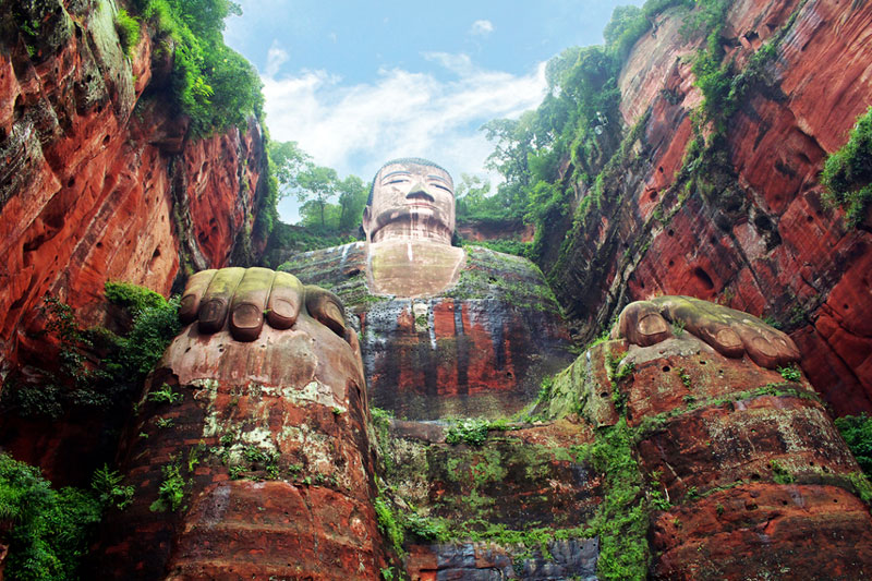
This 223-foot tall Buddha statue is the tallest pre-modern statue in the world. Built in the year 713, the giant Buddha was built by a Chinese monk called Haitong, who wanted to calm down the turbulent and dangerous Minjang River. Amazingly, he succeeded. During the construction of the giant Buddha, so much rock fell from the cliffs that it changed the depth of the water and made the stormy river suitable for trading ships. [Locate Leshan Giant Buddha, China on Google Maps]
16. Aogashima, Japan
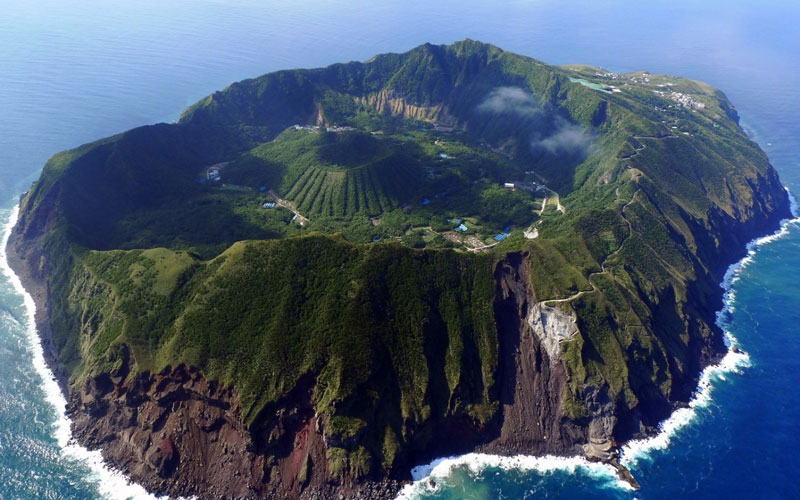
Aogashima is unusual volcanic island located about 200 miles off the coast of Tokyo and is inhabited by about 200 residents. We’re not sure about the island’s dinosaur population – one would suspect it’s scarily high. What makes Aogashima so amazing? Aside from its CGI-like looks, it’s one of the few volcanic islands that’s home to a volcano inside another volcano. Check it out – inside the giant caldera is a second active volcano, surrounded by residential homes. The perfect home for a James Bond villain, this volcanic wonderland is surprisingly safe. It last erupted in 1785, killing off more than a third of the island’s population. [Locate Aogashima, Japan on Google Maps]
17. Fly Ranch Geyser, Neveda
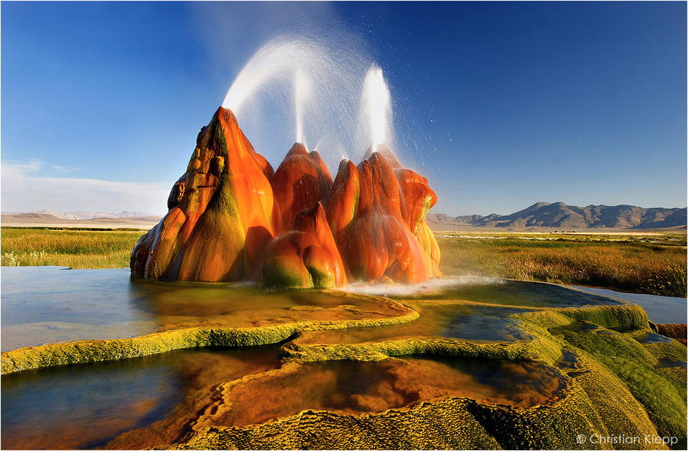
Fly Geyser, also known as Fly Ranch Geyser is a man-made small geothermal geyser located in Washoe County, Nevada approximately 20 miles (32 km) north of Gerlach. Fly Geyser is located near the edge of Fly Reservoir and is only about 5 feet (1.5 m) high, but 12 feet (3.7 m) counting the mound on which it sits in 2013. Fly Geyser is located on the private Fly Ranch in Hualapai Flat, about 0.3 miles (0.48 km) from State Route 34. The ranch is currently owned by Todd Jaksick. There is a high fence and a locked gate topped with spikes to exclude trespassers. The only access is a dirt road, but it is large enough to be seen from the road. Fly Geyser is not an entirely natural phenomenon; it was accidentally created by well drilling in 1964 exploring for sources of geothermal energy. The well may not have been capped correctly, or left unplugged, but either way dissolved minerals started rising and accumulating, creating the travertine mound on which the geyser sits and continues growing. Water is constantly released, reaching 5 feet (1.5 m) in the air. The geyser contains several terraces discharging water into 30 to 40 pools over an area of 30 hectares (74 acres). The geyser is made up of a series of different minerals, but its brilliant colors are due to thermophilic algae. [Locate Fly Geyser on Google Maps]
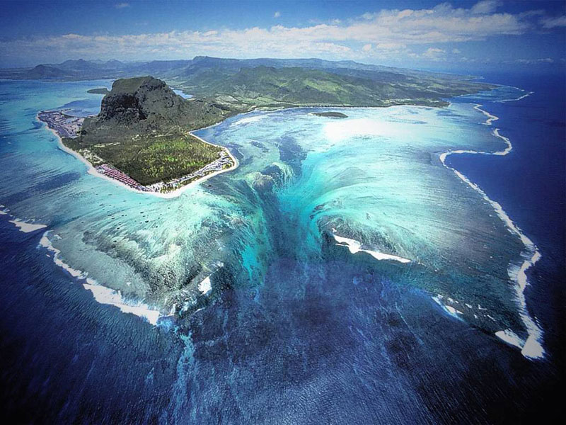
18. Underwater Waterfall of Mauritius Island
Photograph by The St. Regis Mauritius Resort
Mauritius is an island nation in the Indian Ocean about 2,000 kilometers (1,200 mi) off the southeast coast of the African continent. Mauritius was first discovered by the Arabs in 975 AD, then by the Portuguese between 1507 and 1513. Since then there have been periods of succession and colonization between the French, Dutch and British. The island became a republic in 1968. Located at the Southwestern tip of the island you will find a fascinating illusion. When viewed from above, a runoff of sand and silt deposits creates the impression of an ‘underwater waterfall’. Satellite views are equally dramatic, as an underwater vortex seemingly appears off the coast of this tropical paradise. [Located Underwater Fall of Mauritius Island on Google Maps]
19. Hidden Beach, Parque Nacional Islas Marietas, Mexico
Photograph by: Miguel Naranjo
Located in the mouth of Banderas Bay are the beautiful Las Marietas Islands, about 22 nautical miles west of Puerto Vallarta, Mexico. Formed by volcanic activity over thousands of years, the islands are a nationally protected bird sanctuary, also providing shelter for countless marine species. After years of scientific research and an intensive effort to legally protect this archipelago, first championed by Jacques Cousteau, it was finally pronounced a national park, Parque Nacional Islas Marietas, in 2005. The park spans almost 1,400 hectares. On one of the islands is Playa de Amor, more commonly known as Hidden Beach. To reach this secluded paradise, visitors need to swim through a short tunnel, opening up into the stunning beach seen here. There are a number of tour operators providing day trips to this ecological marvel. [Locate Hidden Beach, Parque Nacional Islas Marietas, Mexico on Google Maps]
20. Mount Roraima (Tepuy Roraima / Cerro Roraima) Venezuela
Mount Roraima, also known as Tepuy Roraima and Cerro Roraima is the highest of the Pakaraima chain of tepui plateau in South America. First described by the English explorer Sir Walter Raleigh in 1596, its 31 km2 summit area is defended on all sides by tall cliffs rising 400 meters (1,300 ft). The mountain also serves as the triple border point of Venezuela, Brazil and Guyana. [Locate Mount Roraima (Tepuy Roraima / Cerro Roraima) Venezuela on Google Maps]
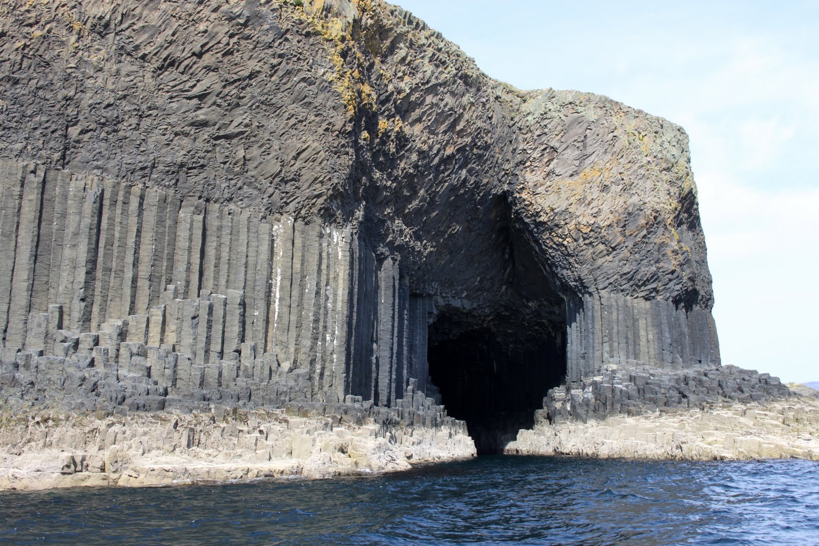
21. Fingal’s Cave, Isle of Staffa, Scotland, UK
© 2009 Jim Richardson/National Geographic
Fingal’s Cave is a sea cave on the uninhabited island of Staffa, in the Inner Hebrides of Scotland, part of a National Nature Reserve owned by the National Trust for Scotland. It became known as Fingal’s Cave after the eponymous hero of an epic poem by 18th-century Scots poet-historian James Macpherson. It is formed entirely from hexagonally jointed basalt columns within a Paleocene lava flow, similar in structure to the Giant’s Causeway in Northern Ireland and those of nearby Ulva. [Locate Fingal’s Cave Scotland on Google Maps]
22. Underwater River, Cenote Angelita, Mexico
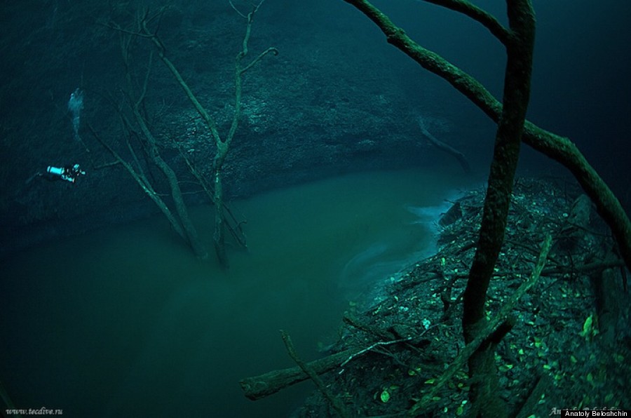
Photographed by Anatoly Beloshchin
Photographed by Anatoly Beloshchin
It seems improbable, but these photographs by Anatoly Beloshchin tell the story of a hidden underwater river in in Mexico’s Yucatan Peninsula called Cenote Angelita or “Little Angel”. While it appears as though the divers are hovering in the air above a small creek, the photos were shot entirely in a submerged cave formed from collapsed limestone bedrock called a cenote. The river itself is actually a sort of illusion due to a phenomenon called a halocline, where waters with different levels of salinity form into layers because of a variation in density. According to Beloshchin, Cenote Angelita is comprised of fresh water until about 29 meters when it switches to a 1-meter layer of hydrogen sulfide, after which the entire cave bottom is filled with saltwater from 30 to 60 meters deep. So in reality the “river” is actually just a dense layer of saltwater resting at the bottom of a cave. [Locate Underwater River, Cenote Angelita, Mexico on Google Maps]
23. Naica Mine – The Cave of Crystals, Mexico
Photograph by Carsten Peter, Speleoresearch & Films, National Geographic
The Naica Mine of the Mexican state of Chihuahua is a working mine that is best known for its extraordinary selenite crystals. Located in Naica in the municipality of Saucillo, the Naica Mine is a lead, zinc and silver mine operated by Industrias Peñoles, Mexico’s largest lead producer. Caverns discovered during mining operations contain crystals of selenite (gypsum) as large as 4 feet (1.2 m) in diameter and 50 feet (15 m) long. The Cave of Crystals (Cueva de los Cristales) is a cave approximately 1,000 feet (300 m) below the surface in the limestone host rock of the mine. The chamber contains giant selenite crystals, some of the largest natural crystals ever found. The selenite crystals were formed by hydrothermal fluids emanating from the magma chambers below. The cavern was discovered while the miners were drilling through the Naica fault, which they were worried would flood the mine. [Locate Naica Mine – The Cave of Crystals, Mexico on Google Maps]
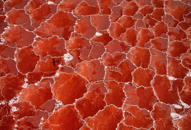
24. Lake Natron, Tanzania
Photograph by George Steinmetz, National Geographic
Lake Natron is a salt lake located in northern Tanzania, close to the Kenyan border, and just north east of the Ngorongoro Crater, in the eastern branch of Africa’s immense Great Rift Valley. Nestled between rolling volcanic hills and deep craters, Lake Natron sits at the lowest point of the rift valley – 600m above sea level – and is probably the world’s most caustic body of water. The lake is fed by the Southern Ewaso Ng’iro River and also by mineral-rich hot springs. It is quite shallow, less than three meters (10 feet) deep, and varies in width depending on its water level, which changes due to high levels of evaporation, leaving concentrations of salt and other minerals, notably sodium carbonate (natron). The surrounding country is hot and often very dry and dusty – not very conducive to travel. But for those who do choose to visit Natron, they are rewarded with some of the most dramatic scenery they have ever see in Tanzania. It is said, that the journey alone is worth it for the views. [Locate Lake Natron, Tanzania on Google Maps]
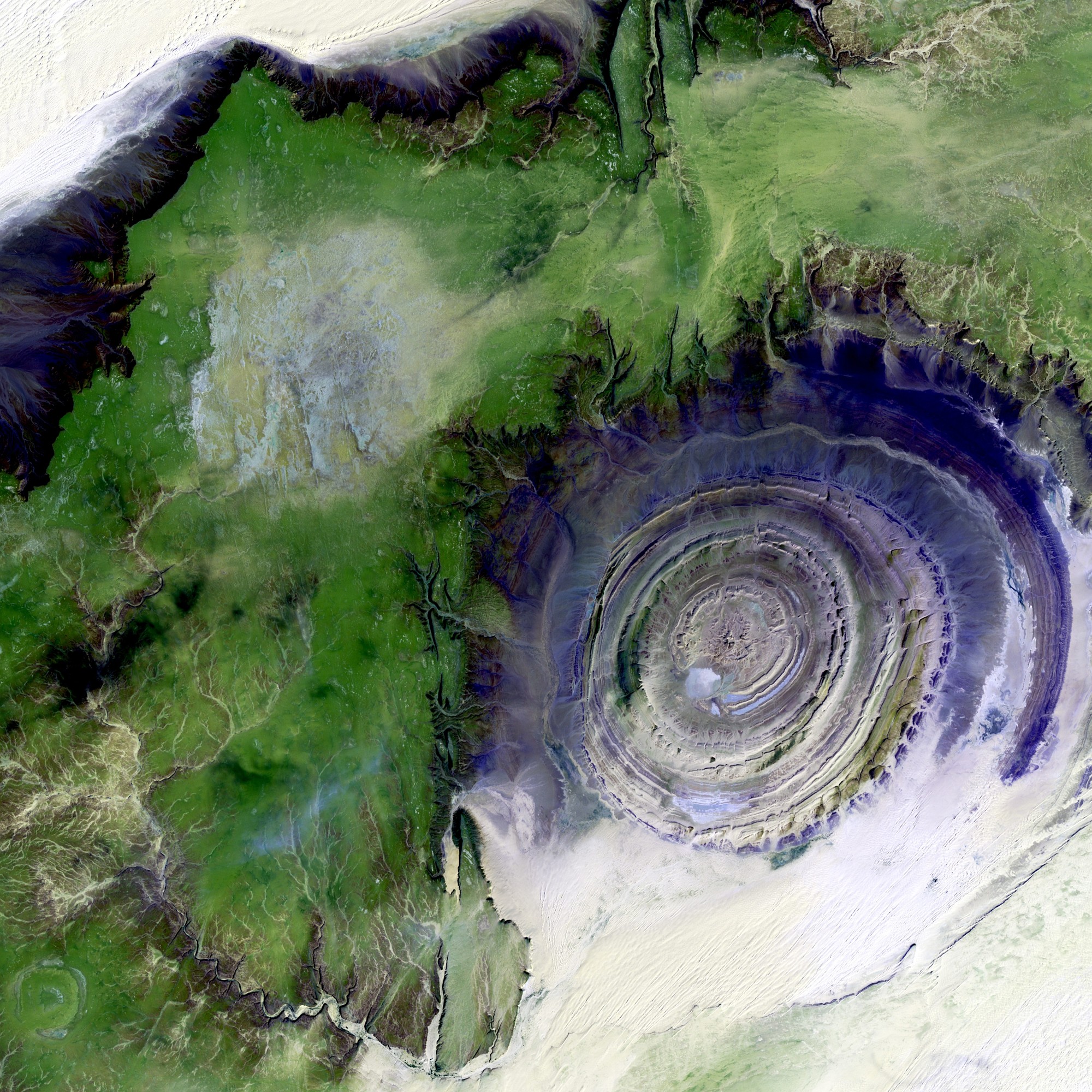
25. Richat Structure, Eye of The Sahara Desert, Mauritania
Look into the Eye of Sahara, isn’t it impressive? The Richat Structure is a prominent circular feature in the Sahara desert lying in the west-central Mauritania near Ouadane. This structure is a deeply eroded, slightly elliptical dome, 40-km in diameter. Differential erosion of the resistant layers of quartzite has created these high-relief circular cuestas. Its center consists of a siliceous breccia covering an area of approximately 3 km in diameter. Initially, there was a theory that the structure appeared as a result of an extraterrestrial asteroid impact. Looking at the circularity of the Eye, you might be inclined to believe it, but the point is now argued to the favor of highly symmetrical and deeply eroded geologic dome. [Source: Abduzeedo.com] [Locate Richat Structure, Sahara Desert, Mauritania on Google Maps]






That’s just cool!
I so want to go to all of them now.
excellent job!